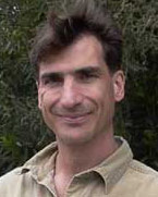
Hart, Quinn

Quinn Hart
I’m currently working on these main projects. The CERES project, and it’s companion site CaSIL, are both primarily concerned with making more environmental information available to the California public. CaSIL is a repository for GIS data, and CERES does everything else. We’ve been developing search and browse interfaces to the dataset, and have developed many different applications for CERES.
Along those lines, I work on the COMET project, which intends to combine a number of different distributed data sets having to do with environment and climate change for a strip of California from Bodega Bay to Lake Tahoe.
Currently, I have a project with California’s CIMIS program, where we combine GOES weather satellite data with surface measurements to provide estimations of evapotransipiration for California. Evapotranspiration is a measure of how much water plants need for a particular day. The information helps farmers determine how much to irrigate or gives water managers an idea of the water use in their area. I manage the satellite station for that imagery here at UC Davis.
Contact:
Quinn Hart
Department of Land, Air and Water Resources
University of California, Davis, CA 95616-8527
Phone: (530) 752-7857
Fax: (530) 754-5491


