
- Current Projects
- Past Projects
- Environmental Hazards and Disaster Response
- Landscape Ecology
- Leaf and Canopy Spectroscopy Studies
- Hydrology and Watershed Assessment
- Assessing the Spread and Persistence of Submersed Aquatic Vegetation Using Hyperspectral Remote Sensing
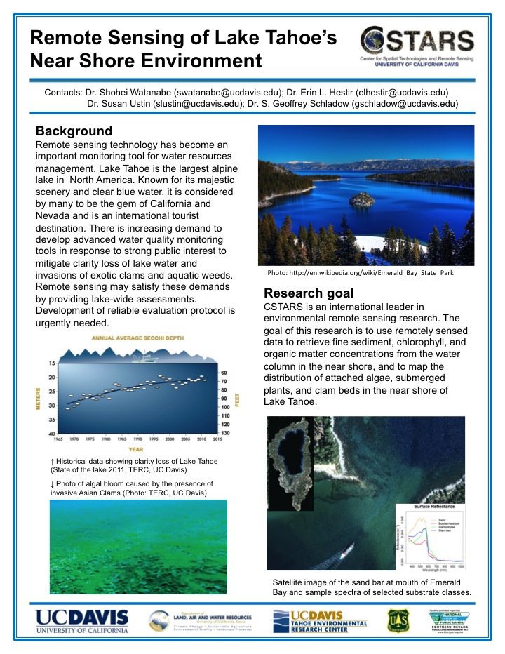
- Remote Sensing of Lake Tahoe's Near Shore Environment
- Brazilian Waterweed Success in the Sacramento-San Joaquin Delta
- Trends in Submerged Aquatic Vegetation and Water Clarity in the Sacramento-San Joaquin Delta
- A Summary of MODIS Water Content
- Agriculture
- Ecosystem Function and Structure
- Education and Outreach
Home > Research Projects > Past Projects > Hydrology and Watershed Assessment > Remote Sensing of Lake Tahoe's Near Shore Environment
Remote Sensing of Lake Tahoe's Near Shore Environment